

From direct broadcast satellites (DBS) and earth observation to navigation and government/military systems, satellite communications (SATCOM) requires extreme accuracy and reliability. Performance is essential, and there must be seamless communication to make sure transmissions are uninterrupted, despite challenges posed by the atmosphere and an increasingly crowded spectrum.
SATCOM
Satellite Communications is an artificial satellite that is used to help telecommunication by transmitting signals from earth to the geo-stationary satellite that receives, amplifies and relays the signals back down to Earth. It is a powerful form of radio and can cover far more distance and wider areas than most other radio technologies. It can also communicate with words, pictures and other forms of information.
Earth Station Configuration
Earth station can be broken down into the following major elements: the RF terminal (including the antenna), the baseband and the control equipment, and the user interface. In addition to these electronic systems, every fixed Earth station must be supported by a physical facility capable of housing the equipment, supplying reliable electrical power, and maintaining the temperature and humidity of the electronics within acceptable limits.
Ensure Optimum Performance for SATCOM Systems
The rise in unauthorized carriers, cross-polarization interference and other issues has made Radio Frequency Interference (RFI) an on-going concern for the SATCOM industry. Essential to the quick resolution of RFI is the ability to rapidly detect, characterize and geolocate the source of interference.
There are also natural transmission challenges. Ionospheric scintillation and satellite propagation effects from the troposphere can cause transmission problems. Engineers must understand these atmospheric conditions in order to design components and systems that can overcome them.
Engineers are also developing free-space optical communication (FSO) systems for high data rate, long-range, point-to-point links. FSO has been developed to meet the need for high-speed and tap-proof communication systems for both military and commercial use.
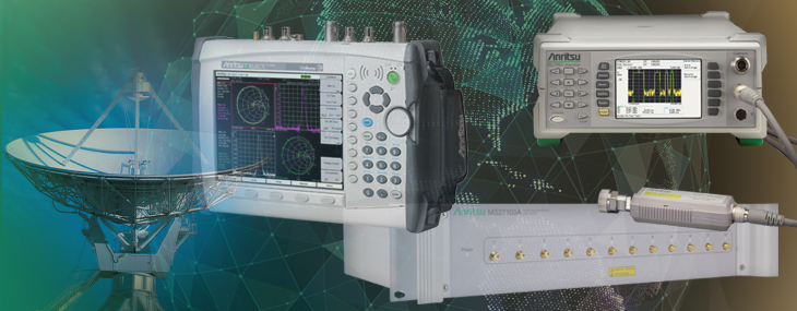
For all these reasons, SATCOM engineers must use test equipment that provides the most accurate stimuli and measurements.
For highly accurate peak and average power measurements, power meters, which have a mainframe video bandwidth of 65 MHz and an effective settable sample resolution of 1ns in a high resolution repetitive sample mode are necessary.
Whether it is for commercial navigation systems such as GPS or military systems that aid in operations, accurate signal transmission is critical.
Coverage Mapping with GPS
Most wireless communications systems are designed to provide coverage over a predetermined area and not interfere with distant systems using the same frequencies. Coverage estimation software must make assumptions about loss due to terrain, buildings and other factors. If the assumptions are not accurate, the actual coverage of a system will differ from the design. Mapping the coverage with a precision receiver provides the ultimate proof and can help separate interference issues from signal strength problems.
Maps sourced from Google can be displayed as Terrain Maps, Road Maps, Hybrid Maps (a combination of satellite and road maps) and as Satellite view maps. However, Google Maps is not available in every country due to country specific restrictions. MapQuest-sourced maps are available as road maps, and come from the OpenStreetMaps movement. At this time, they are freely downloadable wherever internet access is available.
The easyMap software translates the map source into a format readable by Anritsu handheld spectrum analyzers. Two map formats are available; legacy .map files and the new Anritsu Zoomable Map (AZM) .azm files. AZM map files allow up to seven zoom levels and panning and zooming using the interference analyzer. The result is the ability to hunt interference over a large geographic area and at the same time show the detail needed to locate what you find.
Interference in Satellite Systems
A typical earth station will consist of many satellite dishes, all of which need to be monitored in real time. A multiport remote spectrum monitor enables the spectrum of each satellite uplink or downlink to be monitored for spectral purity and the presence of interferers. Alarms can be automatically triggered on detection of unwanted interferers that would degrade the signal integrity.
Satellite Signal Analyzer Option
The satellite signal quality measurement option provides information on link quality and real-time performance data on signals of interest. Parameters such as C/N, MER, EVM and modulation/code schemes are presented. Users can also take advantage of the Statistical Table to monitor signal quality parameters over time. In this way, signal integrity issues can be addressed before catastrophic failures result. DVB-S1, DVB-S2 and IESS satellite signal standards are supported.
Users can monitor signal quality parameters such as EVM or MER, triggering an alarm when values fall below a certain user-defined threshold. Email notifications can then be sent in real time to company technicians responsible for system maintenance.